Monday, October 19, 2009

Cole's Pond - Enfield, NH

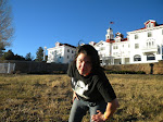
The shoulder has healed from my fall in July. I found it hard to type with a broken shoulder but I got some serious amount of hiking in this summer. Lots of AT and lots of new sites to see. Got rained on, sunburn, soaked of sweat and been put in awe from the trails I visited. I'll tell you about them in my next blog. New Hamphire is truly unbelievable.

Today, I headed out before breakfast for a morning hike at Cole's Pond. I was so excited because I'd never been there without snow on the ground. I would be seeing it in a totally different light, including foliage time.

To get there, take Exit 17 off I-89 (from either direction). Head towards Canaan/Enfield on Rt. 4. After about a mile Rt 4A will be on your right, head through Enfield Village and take a right on Bog Road. Cole's Pond will be on your right in about a mile. Park right on the side of the road near the trail head sign. It starts with a foot bridge going over a small stream.

The trail is very easy, some short climbs, but nothing too hard. It is a great "One Arm Hike". About thirty minutes of slow to moderate speed of hike will get you there. At Cole's Pond, there's some fishing boats (left by seasonal fly-fishermen) and a path that leads around it. It's a great view and it was gorgeous up there with the fall colors. I've seen moose tracks there in the winter so I know they're around.

The last time I was at Cole's Pond, in February, we hiked up the hill on the left of the pond and found a fort. If you aren't good with your sense of direction - please don't try to find it. Getting lost in the woods without a path to follow isn't fun. I have no idea why or what the fort is for. I hope if you find it, no one is there. Please be careful and don't go alone.

On the way back down retrace the same trail that brought you up to the pond. It's a great walk for everyone to enjoy all year long. If you want to fish there, only fly fishing is available and they stock the pond for anglers. It's bound to have some good size fish.

The hike was almost as good as a perfect cup of coffee. It was refreshing to get out there before noon and the light was awesome for taking foliage pictures. Morning light is always amazing. If you've been on this hike chime in and tell us about your adventure. Comments are always welcome and encouraged for new ideas for readers.

Tuesday, July 14, 2009

Bicknell Brook Trail/Enfield, NH - One Arm Hike #2

The Bicknell Brook Trail in Enfield was a new trail for me to hike today. I've gone by it on my way to Grafton Pond with my kayak and I always wanted to explore it. I took a look at the trails and map about a week ago and it seems to be a straight forward hike through the woods.

It's easy to get to; it's off of Grafton Pond Road via Route 4 in Enfield, NH. It's a little more than 1/2 mile down the road on the left, marked "Colette Trail/Bicknell Brook Trail". At the trailhead parking lot there a wooden map with the run of the land and it show the brooks that you'll hike along and it shows the 2 mile loop that you'll be following in red.

Heading into the wood you head down a little decline to a fork in the trail. I followed the Colette/Bricknell Brook Trail to the right. There were some muddy spots at first but it leveled out and turns into a really nice narrow wooden trail surrounded by pine trees. You'll be able to hear the brook ahead. Once your upon the brook you'll walk along the bank for a good part of the hike before you loop back around to head back to the parking lot.

Once you hit the trail junction of the Colette Trail heading towards Crystal Lake take the remainer of the trail to your right and head back towards the Grafton Pond Road parking lot. I noticed there are number markers in decending order along the trail. I'm not sure if they mark things on the trail of just act as just markers for the trail. The way I explained they acted like a countdown to where the trails would join up. When they join up again, head back up the hill to the parking lot.

I thought this is a great place to go for a picnic or maybe swimming in the brook. I followed the Colette Trail a bit to a bridge and a lookout among the marsh at the brook's junction. I didn't have a map of this trail and not knowing how long it was or the area it went through I didn't continue down it.

If you get a chance to try this trail let me know what you think.

Quechee Gorge/Quechee, VT - One Arm Hike #1

Are you looking for a less stress, no fuss hike? Quechee Gorge is it. One for all ages and plenty of changes to keep it a different hike everytime you go.

Getting there is easy take Exit 1 (Route 4) of I-89 and head towards Quechee/Rutland, VT. It's a left off both the North and Southbound highway ramps. A few miles down you'll be able to see the Vistor's Center on the right and the hot dog/Quechee Gorge Gifts on the left. You can park in either parking lot. Both places have an entrance to the trails.

I suggest heading down to the rock quarry first to the left when you get on the main trail. It's mostly downhill and a easy hike. At the bottom, depending on the rainfall, you'll see the Ottauquechee River opening up upon the rocks. If the rocks are showing you can climb across the rocks to the river's edge. If it's under water, you can take off your shoes and enjoy the cool Vermont river water. If you venture off on the rushing water over the rock plese use caution the rock are very slippery when they are covered with water. Plenty of people swim in the river. It's very refreshing but keep in mind the current is very strong. To return, backtrack the way you came down the hill.

If you need more hiking and sights, you can cross under the bridge and up the stairs to your right and head down to the dam. It's a hydroelectric dam. Lots of red pines usher your way to the dam and onto Dewey's Mill Pond. There's a marshy walk through the thin land bridge between the river and and the pond. The trail ends at a parking lot on Quechee Main St.

There's a campground, pizza place and some other points of interest in that area. Quechee State Park Campground, VINS Nature Center, Fire Stones and Pizza Chef are my favorite places to visit.

Here is the VT State Park site for Quechee Gorge: http://www.vtstateparks.com/htm/quechee.cfm
Here's the map: http://www.vtstateparks.com/pdfs/quecheegeo.pdf

Monday, July 13, 2009

The Prouty - July 11, 2009

July 11, 2009 - Today I set off on the The Prouty in the morning at 5:15am. I was paired up with a riding partner. This is a first time I've ever rode with someone during this event.

About 8 miles into the ride I touched the rear wheel of the rider in front of me with my front tire and I lost my balance and went down. I went down hard. I was the only one that went down, which it good because I did something real dumb and I learned my lesson.

I didn't loose consciousness but I took a moment to recover from getting the wind knocked out of me. After I got up I couldn't move my right arm. I ended up with a crack when I tried to raise it (thinking that I dislocated my shoulder but popped it back in). I lost all strength in my arm. I had strength in my hand and lower arm, but I couldn't raise my arm up on it's own.

I got back on my bike and rode 2 miles to the first SAG stop in Lyme. They weren't even set up yet, but they had they're first accident victim, ME! Dan my partner for the day stood with me until Kim another team member showed up, with ADVIL, that helped a lot. I was tearing up with a lost hope and pride of doing and finishing The Prouty. I'd been training since February. It was a very emotional day for me, even before 7am. I ended up being driven to my car and then I drove myself to the ED at Dartmouth-Hitchcock. The pain from my injury was very real now.

At the emergency department, x-rays were done and after 3 hours in a bed - on & off snoozing, I got my diagnosis. I have a "proximal humerus fracture" at the top on my shoulder. Looking at the x-rays it seems I have 3 fractures near the ball joint of my shoulder. I was given a sling and was told a few basic instructions, because this is the first time I broke a bone, and was sent on my way with a pain medication prescription.

Boy I'm scared. I'm thinking how am I going to work, change my clothes, even wash the dishes. I survived; it could have been a lot worse. Only one section of my arm isn't working...I can still type, and hang on to things with my right arm. I'm trying to keep my shoulder still and hoping for a quick recovery. I thank both Dan and Kim from my team, Chain Reaction for staying with me and giving me support that I needed for this scary time in the EMT tent. Thank you to Tom the EMT at the Lyme SAG stop for keeping me calm and talking to me about mountain biking and making sure I was alright.

So for the next few weeks of my recovery, we'll be discovering places where I can visit with a broken shoulder. This is all new for me.

Thursday, July 9, 2009

Mt. Cardigan/Orange, NH

A great local, easy to get to hike is Mt Cardigan. It's great for beginners and it was my first hike when I started hiking. It's a short hike to a great pay-off at the top of the mountain. You can see views of Vermont mountains - Okemo, Killington and Ascutney - and New Hampshire's Ragged, Sunapee and Kearsage Moutains on the Southwest side and the White Mountains on the Northeast side of the peak.

Take Rt. 4 towards Canaan from Rt. 89, when you get into the center of Canaan, follow the signs to Mt. Cardigan (down Rt. 118 and the Orange/Cardigan Mountain Road past Canaan Speedway). The road leads upward towards the West Side Hiking Trails parking lot. There you can pick up a free map of the region.

Head up the West Ridge Trail right near the shelter. It's a very easy trail to follow, blazed in orange. It's a awesome hike through the woods up rocky terrain and make shift stairs. Close to the peak the treeline falls back and the trails turns to rock under foot. The mountain is mostly bare until the peak. You can catch plenty of views of the mountains of Vermont. You are just getting a preview of what's at the peak.

You'll see the watch tower, then you know you're close. Follow the stone heads along the trail to the peak. Once there you'll be able to see many New Hampshire and Vermont mountains and lakes. It's simply breathtaking. The clearer the day, the further you can see. Today it was a cloudy day with a few showers developing, you could see the weather patterns on the peaks of other mountains and valleys.
The top of Cardigan was made bare by a fire in 1855. It burnt away most of the vegetation and soil and it still remains the same today. It's easy to spot Mt. Cardigan from other mountains and viewpoints because of it's bare peak. No trees means - nothing in the way of your view. It's a one of a kind.

View of Killington and Okemo

View of the White Mountains under cover

On the way back down you can go back the trail you can up, but I recommend the South Ridge Trail, blazed in white. It goes to the second peak and to Rimrock. It's just another way up and down the mountain with different views of the landscape. Once you get to Rimrock, take a right down the Skyland Trail (blazed in orange) toward the West Ridge Trail. You'll know when you hit the West Ridge Trail again because you'll see the bridge to your right. Head back down the West Ridge Trail (to your left) to the parking lot. There are restrooms at the far left of the parking in a gray building.

If your looking for an alternative, less crowded, way I suggest up the South Ridge Trail and down the West Trail for your next visit to Cardigan you can even fit in the Skyland Trail towards Mt. Gilman, a mile away from the Rimrock junction. The best part about Cardigan is that there are always families and large groups there enjoying the hike. It's a hike for everyone.

Let me know what you think when you get a chance to check the mountain out.
Here's the link to learn more: http://www.friendsofmountcardigan.org/

Sunday, June 28, 2009

Outdoor Supplies List

Every good player is only as good as their equipment. So let's take a look at things you should pack in order to be safe in the outdoor adventures we'll go on.

Water, food and shelter - are the human essentials.

For water get a backpack or a hip pack that has a place to put a water bladder or at least two water bottles. It's a bummer to be stuck out in the middle of "nowhere" without any water to drink, so make sure you bring plenty of it. I haven't tried the water purification tablets as of yet, but packing them wouldn't be a bad idea, just in case. I recommend a Camelbak or a Coleman hydration back pack. They are easy to drink from and they have extra pockets for storing your gear.

As far as food is concerned I bring as much relative to the time I'll be out. I bring a sandwich and/or snacks (trails mix, fruit or beef jerky) to help with keeping up energy when feeling a little lightheaded from being hungry. Also, it's nice to have when you take a break at a top of a mountain or by a stream on a hike.

Shelter doesn't mean pack a tent everywhere you go. It means, pack something that can protect you from the elements in case the weather turns bad or you need to spend the night. I have a waterproof windbreaker or rain poncho always! There are sometimes man-made shelters on many hiking trails like the Appalachian Trail, which are neat places to stay.

Depending on the size and the weight of your pack, you should carry more than just the basics to enjoy your adventure. Other supplies I highly recommend you include are: a map of the area, cell phone, flashlight or head lamp, gloves, ski hat, pair of socks, compass, waterproof matches or working lighter, first-aid kit, insect repellent, sunscreen, multi-tool, whistle, signal mirror and sunglasses. Have a good pair of waterproof hiking boots or trail shoes too. Some "nice to have" supplies are: a bandanna, extra batteries, hand warmers, camera, lip balm, hunting knife, emergency blanket, rope, cash & ID, a road flare, toilet paper, plastic bags, an extra vehicle key and a GPS unit.

You can never plan for what will happen outdoors but you can plan on being prepared. I pack this stuff in my pack EVERY TIME I head out. I like to be prepared. You'll feel a little weighted down at first when you start out with these supplies, but the first time you have to use any of it you'll be glad you have it.

Just a side note: It's a good idea and practice to tell someone where you are going, when you're going and when you'll be returning.

New Blogger

I want to become a freelance writer, so I got some advice to become a blogger. I believe I'm now in charge of my place to write what I want. I decided to write about discovering the place where I live. I'm in awe of it!

I, as well as other people, have vacationed in New Hampshire and Vermont. I moved here on a career path and since then changed jobs and took on a new position that will assure myself to stay in the area that I love to discover. There are lots of activities and new sights right in my town, over the CT River or in the White Mountains.

In my blog I'll share with you my discoveries and review them in the most objective way I can. Traveling is something I like to do and this blog will reinforce me to 1) get out and discover, and 2) hopefully get you out there too. I'm a mountain biker, hiker, skiier/snowboarder.

I want this blog to teach wonderful places to visit and be interactive. Please feel free to comment on my posts, suggest locations to visit or things you discovered in the places I write about.

I have a day off tomorrow. Where should I go?